
Just to follow up with more fun with Google Earth. I have captured another picture a short distance to the northeast of Angkor. The are many dots scattered in this territory that look like bomb craters. Unlike the fields to the south, there seems to have little trace of human in this area. What are these dots really?
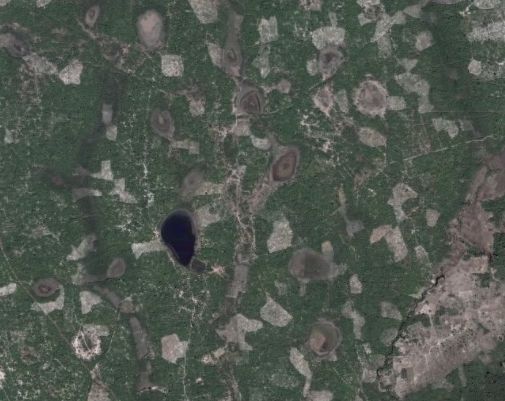
From two independent sources I have found enough information to identify this geography feature. If you have the July 2009 issue of National Geographic, you can check the hand drawn map to see what have they depicted in the northeast area. I have also found one picture from Google Earth that gives ground level perspective. Unlike the Angkor templates of historical fame there aren't thousands of pictures taken there. I have to look hard to find one single picture. But what I saw confirms the illustration from National Geographic.
The answer is they are natural ponds. It appears that they only filled up seasonally. When the pictures was taken they appeared to be mostly dry.
2009.07.05 - comments
 Site feed