原載於旅遊人生討論區
第一次到南美旅遊,剛剛從秘魯回來。徒步從印加古道(Inca Trail)走了四天去迷城馬丘比丘(Machu Picchu)朝聖。又遊覽了遍地都是古蹟和殖民式建築的庫斯科(Cusco)。然後去了富歷史色彩的城市Arequipa,還爬落世界其中一個最深的峽谷Colca Canyon。短短兩星期上山下山跑了多處,又受盡高原反應影響,這次旅程可算是辛苦。不過這亦讓我更切身地體驗壯麗的安第斯山脈和見識南美古文明的遺跡,使我得到一個難忘的經歷。
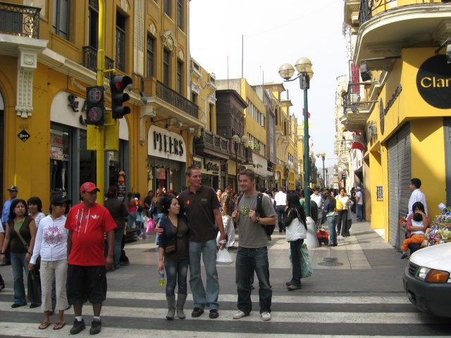
利馬市中心的行人商店街Jirón de la Unión
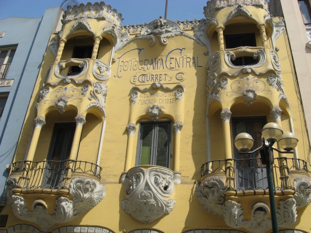
La Casa Courret
這次旅行可謂出師不利,臨出門前染病在家躺了幾天(我猜是染了豬流感),幸而上機前及時病愈。COPA/Continental機票是我用很平的價錢買到的,但代價是一個極差的行程。從三藩市出發到利馬,再轉Taca機到Cusco前後一共用三十小時,更甚的是當中包括連續兩晚通宵。在我多年旅遊經驗當中這航程算是最差的,直可與我在中國坐硬坐火車之苦相比。原本我是一個很易入睡的人,預算在三十小時之中會盡量去睡。但是不長不短每程三四小時的航機共有四班,美國機場候機室的長凳又用乞人憎的扶手隔開,令人無法躺下。第二天半夜到了利馬,入境竟然要大排長龍,入境以後清早起飛的Taca又未開始Check-in。所以第二個夜晚只能糊糊圖圖在機場Food Court熬過。明早到了Cusco以後倒頭就上了旅店的大床睡,睡到中午才勉強跑出去活動。
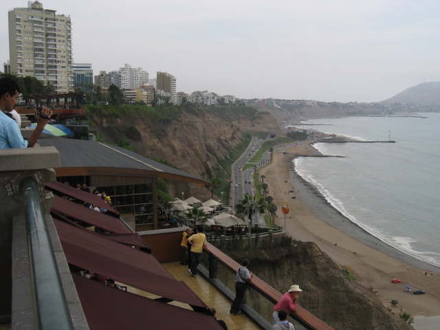
從Miraflores觀懸崖和海灘
印加帝國以庫斯科為首都,於十五,六世紀驟然擴張,版圖包括今日的哥倫比亞、厄瓜多爾、秘魯、玻利維亞、智利、阿根廷等地,成為一個綜橫南美州的龐大帝國。然而其全盛時期只有百多年,十六世紀被西班牙人入侵,印加帝國又驟然滅亡了。
印加國土主要在安第斯山脈,四處盡被崎嶇的山嶺阻隔。為了統治這遼闊的領土,印加王國建設了一個四通八達的道路網絡,使人和貨物得以跨越山嶺流通。又在途中設立不少驛站,以便通訊。印加的工程技術非常高明,這些在陡坡上用石頭鋪成的道路和梯級,經歷了幾百年的使用和暴雨沖擊,到了今天有不少路段仍在。其中一段路通往馬丘比丘,每年有不少遊客專誠到裡,跟隨古人的腳步用數天時間徒步往馬丘比丘探訪。
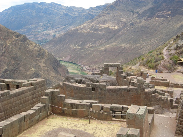
The Temple of the Sun, Písac
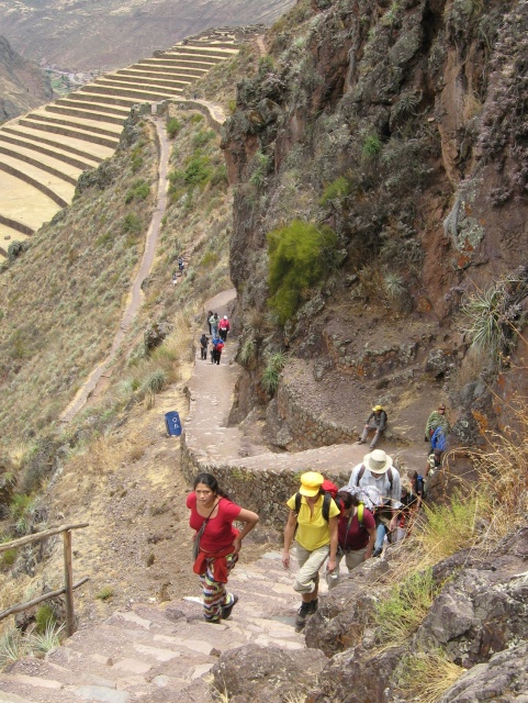
高原缺氧,上這段梯級甚為吃力(Písac)
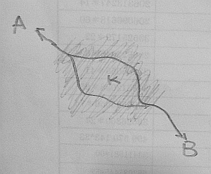
這段印加古道長約43公里,高低起伏的路徑最高點達到4200m,而最低點是高於2400m的終點馬丘比丘,全程分4日3夜完成。除了地勢外,更因為高原低氧的氣候,對體能有一定的考驗。古道沿途經過不少村落和印加遺跡,盡覽壯麗山色,這可算是一條數一數二的遠足路線。
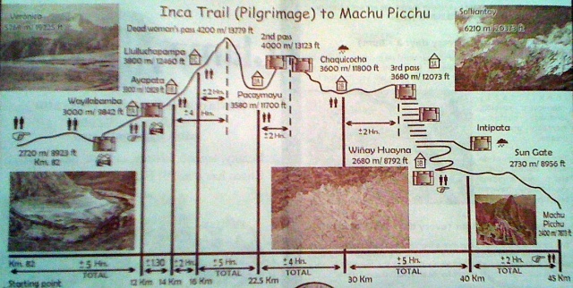
印加古道高度示意圖(from Llamapath)
旅程頭三天在古都庫斯科渡過,一方面四處遊覽,另一方面讓身體慢慢適應高原氣候。印加的建築技術實在精巧,庫斯科四處可見印加遺下的石牆地基。西班牙人摧毀了印加建築物,在遺下的地基上蓋上自己的房子和教堂,那些地基到了今日還是很穩固。Sacsayhuaman的建築實在令人嘆為觀之,石牆由一塊塊龐然巨石切成,居然可以做到天衣無縫,更不需用水泥連結。
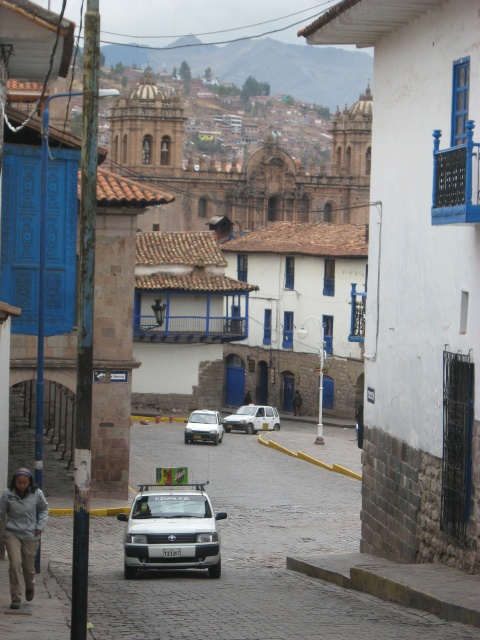
庫斯科街景
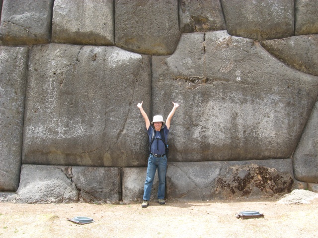
Sacsayhuaman
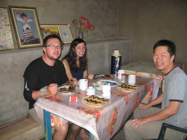
庫斯科菜通常都由一度美味的湯開始,主菜總有各種不同的粟米和馬鈴薯。我吃過羊駝肉,味道有點像羊。連特產天竺鼠也吃過,只是可吃的肉並不多。其實我在庫斯科幾天受高原反應影響胃口都不好,每餐都是勉強地吃完。
庫斯科海拔3310公尺,初到那裡的人可能會有高原反應,但每人反應不一。我和我朋友算是受影響大,那幾天一直都覺得有點頭痛,食慾不振。我們已盡量慢慢的走路,其實想走得快也走不來。過了兩天我覺得已漸漸適應了,怎料第三晚才來大發作,頭痛得厲害,一點飯也吃不下,只有回旅店睡,希望明早出發往印加古道時可以應付得來。
本地人推薦以古柯葉coca製品來對抗高原反應,最常有的是古柯茶,亦可以嚼古柯葉,還有用古柯製葉成的糖。這些所有製品我全都試過,對我是否有用就不可已知了。
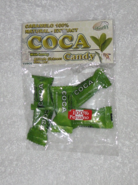
Coca candy味道苦澀
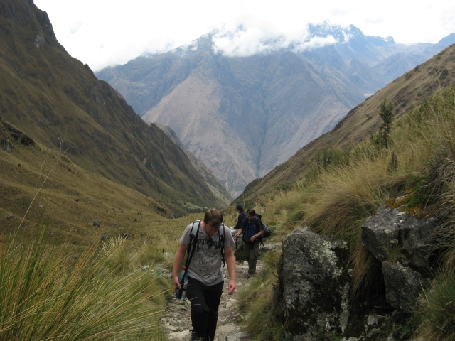
向印加古道出發
第四日清早,帶了輕便的行裝和睡袋到廣場集合,從那裡開了兩小時車到Ollantaytambo。印加古道的起點就在Urubamba河谷旁。吃過早餐,外面早晨天朗氣清,踏過鐵路走到磅礡的Urubamba河岸,河水流過連綿的山巒。這裡的美景令我的心情大好,昨晚的頭痛已消去,而且這裡的高度只有2700多公尺,所以暫時沒有因高原空氣而不適。
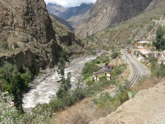
Urubamba河
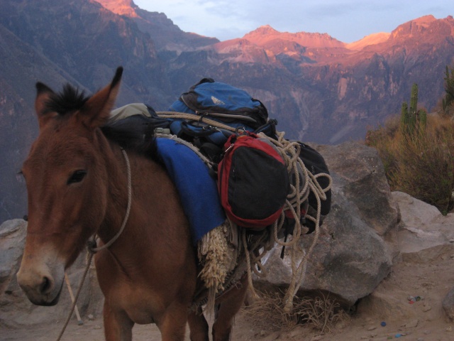
遊客到此必須參加合格的遠足團,團費雖然是貴一點,但是待遇很不俗。營幕和煮食用具等重擔都由挑夫運送,自己只要背著衣服和私人用品,沿途聽導遊介紹風光歷史。一身疲勞來到營地時,挑夫早已把營幕豎立好,還預備好茶點款待,三餐豐富的飲食也包括在內。我們一團共有11人,另有15個挑夫和兩個導遊,比遊客還要多一半。
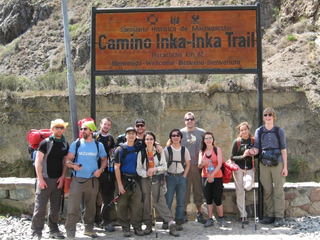
出發前先來一張團體合照
開始時我們沿著河岸而行,途中經過數處印加古蹟可以隔河遙望。沿途亦經過一些小村,甚至有茶寮向遊客賣汽水。中午我們在一條小村落腳,由隨團大廚給我們煮一餐美味的午膳。休息過後向第一晚的營地進發。
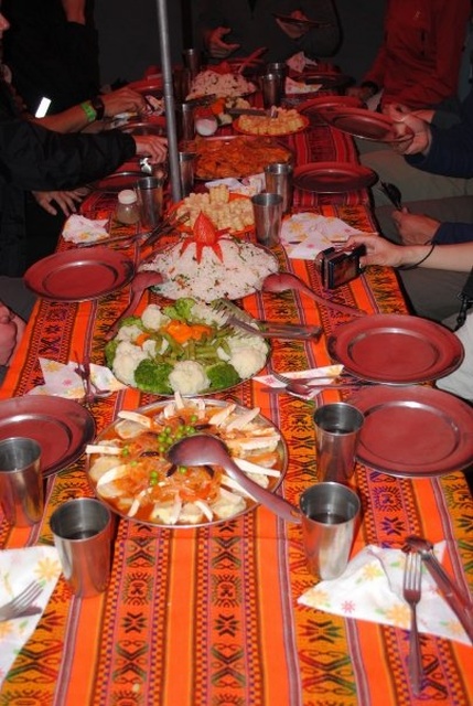
在營幕內豐富的膳食
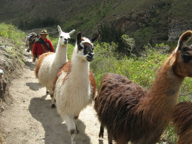
途上遇上一隊羊駝
照導遊所說,第一天的行程算是熱身,路程長度和攀登高度都比第二日少,海拔亦較低,應該不難應付。但我覺得這山路越行越陡峭,人越走越慢,費盡氣力捱到營地是已是黃昏,真擔心明天是否能應付攀越4200公尺山口的挑戰。
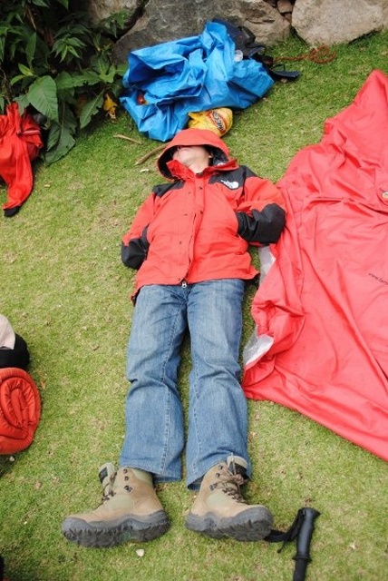
筋疲力盡
沿印加古道而行,每隔不遠就會遇到一處遺蹟。這些建築物多數是建在山崗上或是懸崖邊,堅固的厚石牆大都保存完好。身處高峰之上雲霧飄渺之間,這些古建築大有天空之城的感覺。它們通常都是多用途建築,既是用於通訊和住宿的驛站,儲存糧食的倉庫,也是可觀察軍情的瞭望台。大規模的遺蹟還有房子作長期定居和有梯田作耕種。
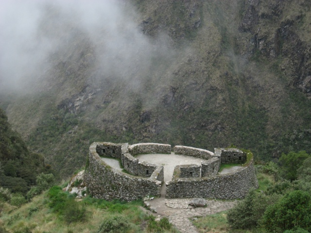
Runkuraqay
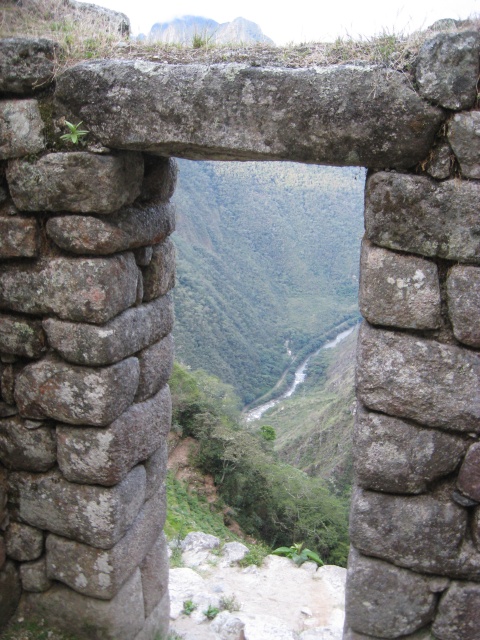
Wiñay Wayna之門
我們第二天的行程是最長最有挑戰性,首先要攀越全程最高點4200公尺的Dead Woman's Pass,從離營地出發大概要爬1000公尺。本來我平日有適量運動,爬1000公尺並不難。但在4000公尺的高山空氣稀薄,行動特別吃力。偏偏我們這一隊人除了我和我朋友外,其他人都是二十來歲年青力壯的小伙子。他們一早就遠遠超前,我們殿後的就隨自己的步伐緩緩向上爬。我們也不知用了多久居然也爬了上去,更可幸是今天我沒有被我最擔心的高原反應影響。本來我們全隊人準備在山口慶祝一番,但就在我們到達時天下了一陣大雹,大得打到臉上也覺得痛。於是大家連忙下山去,甚麼慶祝拍照也不管了。
向Dead Woman's Pass進發
這段印加古道多數用石頭鋪成,上下山坡則建了大級的石級,人們就是靠這些建設才可翻越陡峭的安第斯山。今天的問題是一場雨後石級變得濕滑,在這段下山路我跌了十來次。這還是靠我有一支行山棒支持,否則可能連山也下不了要召救兵。其他朋友如果有興趣這段徒步旅程,行山棒是必備用具。
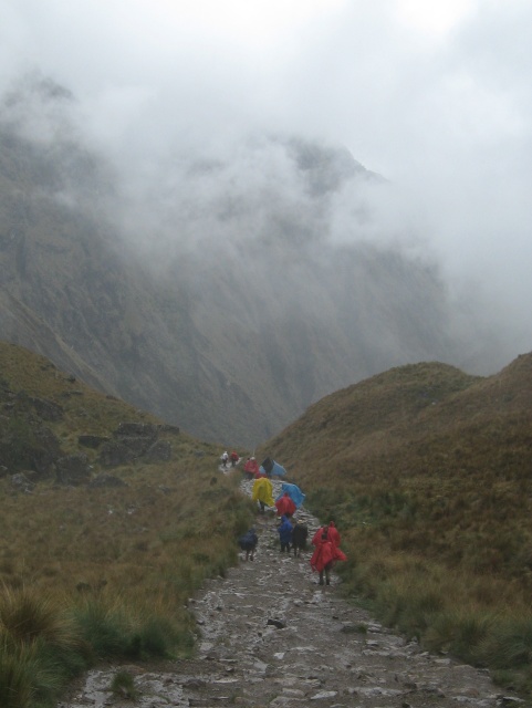
在雨中沿印加石級下山
Dead Woman's Pass只是今天的第一關,午飯後我們還要翻越高4000公尺的第二關才可到達營地。我只是憑著一股耐力,一步一步向上爬,每隔一小段路就坐一坐休息。印加古人可能一輩子習慣在山道跑上跑下,見我這些外人來到,在笑我們真不濟。走到下午五點,我終於到達營地完成今日一整天的行程。
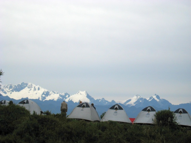
營地
踏足馬丘比丘
第四天早上大家四點鐘起來用早點,再拔營向馬丘比丘進發。今天大家不知為甚麼都好像在賽跑,走得特別快。走到檢查站還要等到五點半才開門,我們是第二隊到達的隊伍。從檢查站再走數公里就來到Sun Gate,在雲霧之間馬丘比丘第一次展現在我們眼前了。
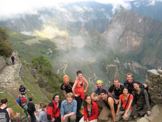
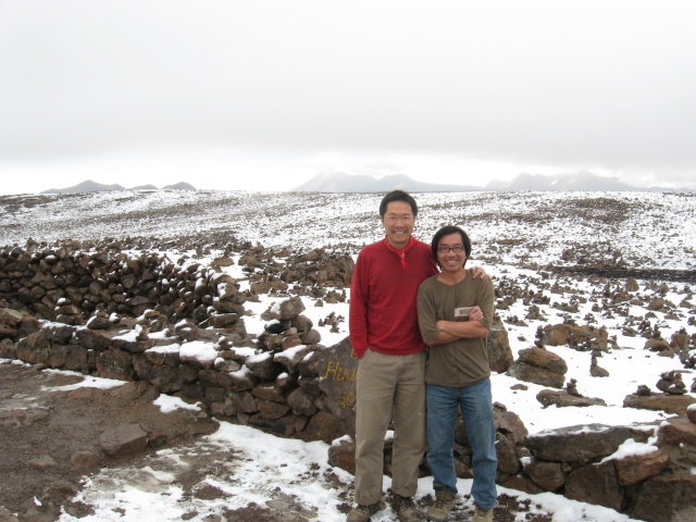
Sun Gate之團體照
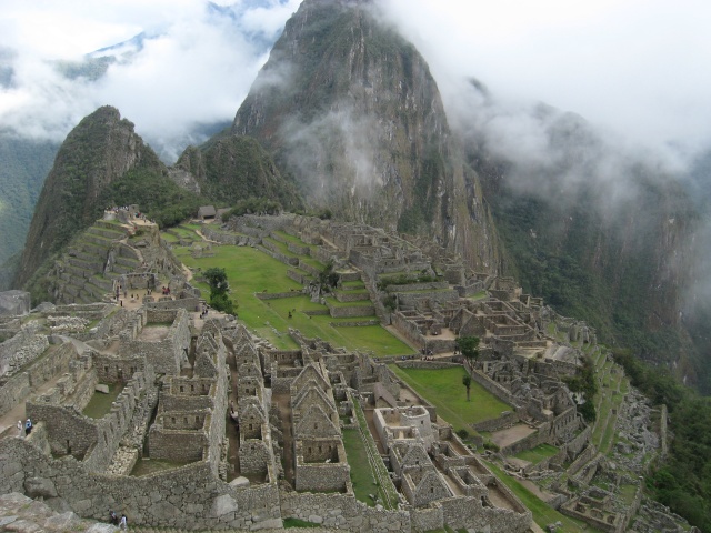
馬丘比丘之絕景,嘆不枉此行
馬丘比丘建於十五世紀印加王朝的高峰期,其建築和佈局都是精心設計建造。學者認為那裏是進行宗教典禮的場所,亦是王族的離宮,還有可能是印加精英的學院和研究農業技術的實驗農場。然而它在建立一百年後西班牙人入侵時候被人遺棄了,這座山城慢慢被森林掩沒,此後逐漸被人遺忘。多年來西班牙人亦沒有發現此城,因此馬丘比丘才沒有像其他印加遺蹟一樣被劫掠和破壞,至今還保留得完好。1911年歷史學家Hiram Bingham來到這裡探險,他原意是尋找歷史中記載的另一個迷城Vilcabamba,那是印加失陷於西班牙軍隊的最後據點。但他卻在村民引導之下發現馬丘比丘,就是這樣這座宏偉的山城才被世人認識。
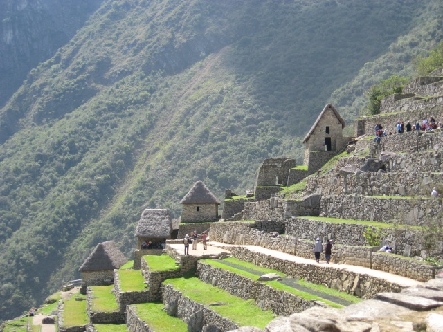
糧倉和梯田
馬丘比丘的面積頗大,我們隨導遊參觀幾個主要的建築群和宗教祭祀的場所。馬丘比丘當地有一個石礦場,從那裡我們對印加石匠破石和打磨的技術有了一點了解,亦可見馬丘比丘當時是個一仍在建造中的城市。城中有一條貫通全城的長樓梯,樓梯旁有一條用石鋪成的水泉,泉水源源不斷地流出。我常奇怪一個文化怎麼會在險峻的崇山之中發展起來,其中原因可能是那裡有肥沃的土壤和充足的水源。
馬丘比丘水泉
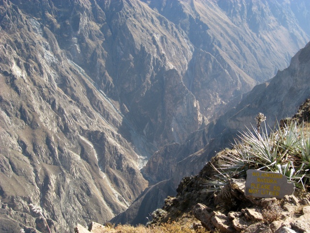
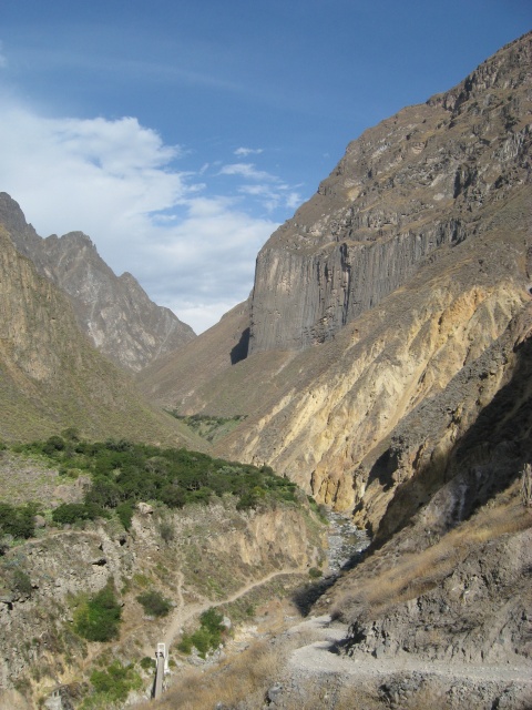
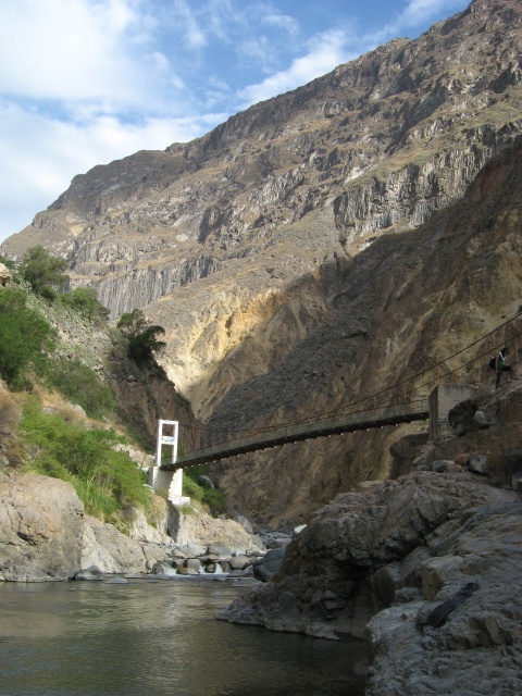
第一部分在印加腹地的旅程在此結束,以後幾天轉到秘魯南部城市Arequipa和Colca Canyon遊覽。
秘魯懷古徒步印加古道(2009)-下編
2014.05.15 [travel] -
comments


 Site feed